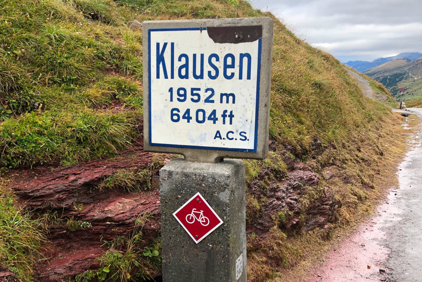
It's been 33 years since TYDAC was founded. And it's also been eight years since our last 25th anniversary event, not least because of Covid. So it was more than time for a get-together!
The Mobile Mapping System from iNovitas (RealityCapture System) consists of several stereo systems, a panorama system, a 360° laser scanner and a navigation solution. It enables mobile and flexible data acquisition on different carrier platforms. From the navigation data recorded during the measurement run, the absolute position and orientation of each camera can be precisely calculated continuously in space, thus creating accurate and highly precise Infra3D Mobile Mapping data.
Integration in MAP+
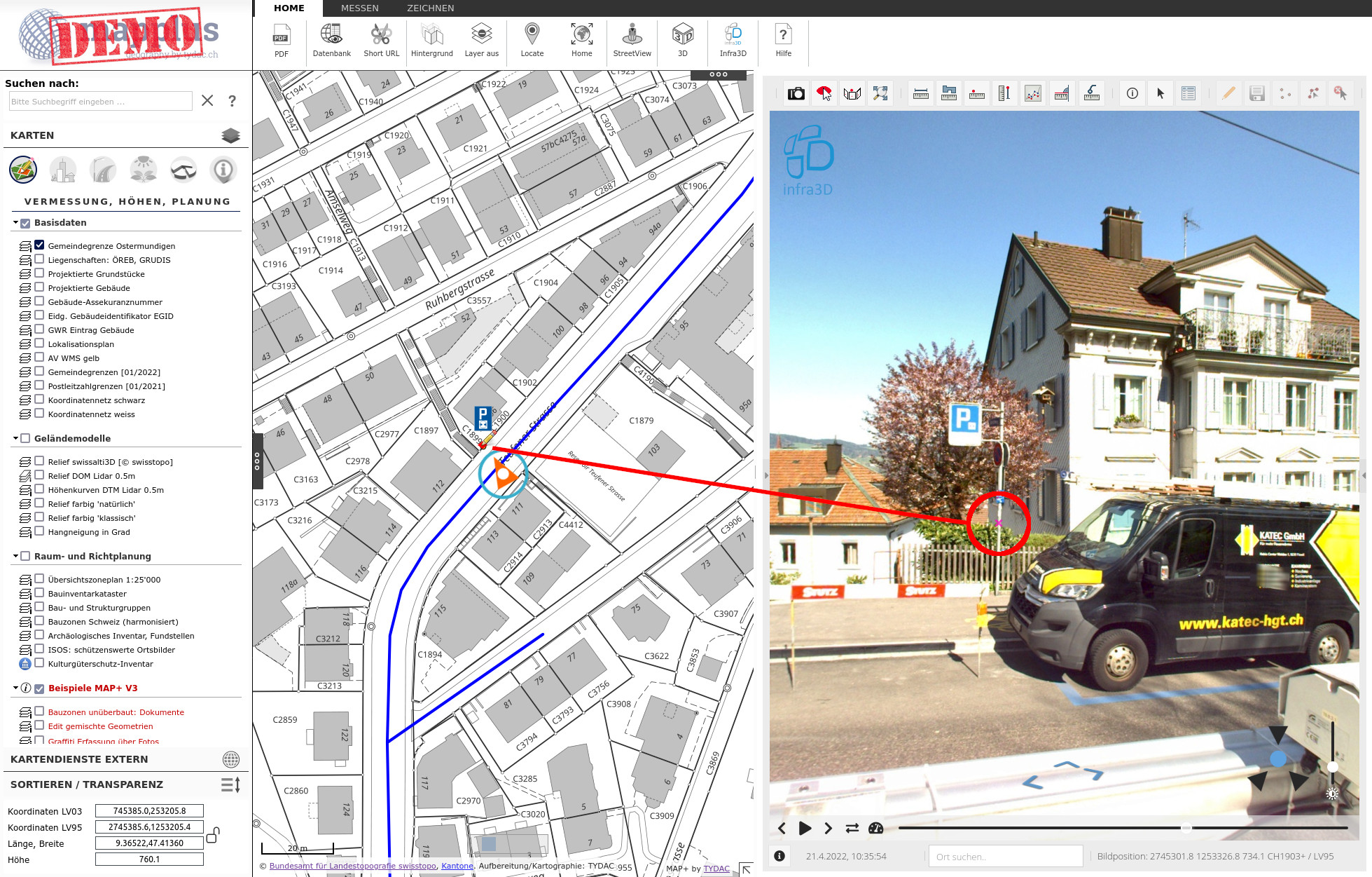
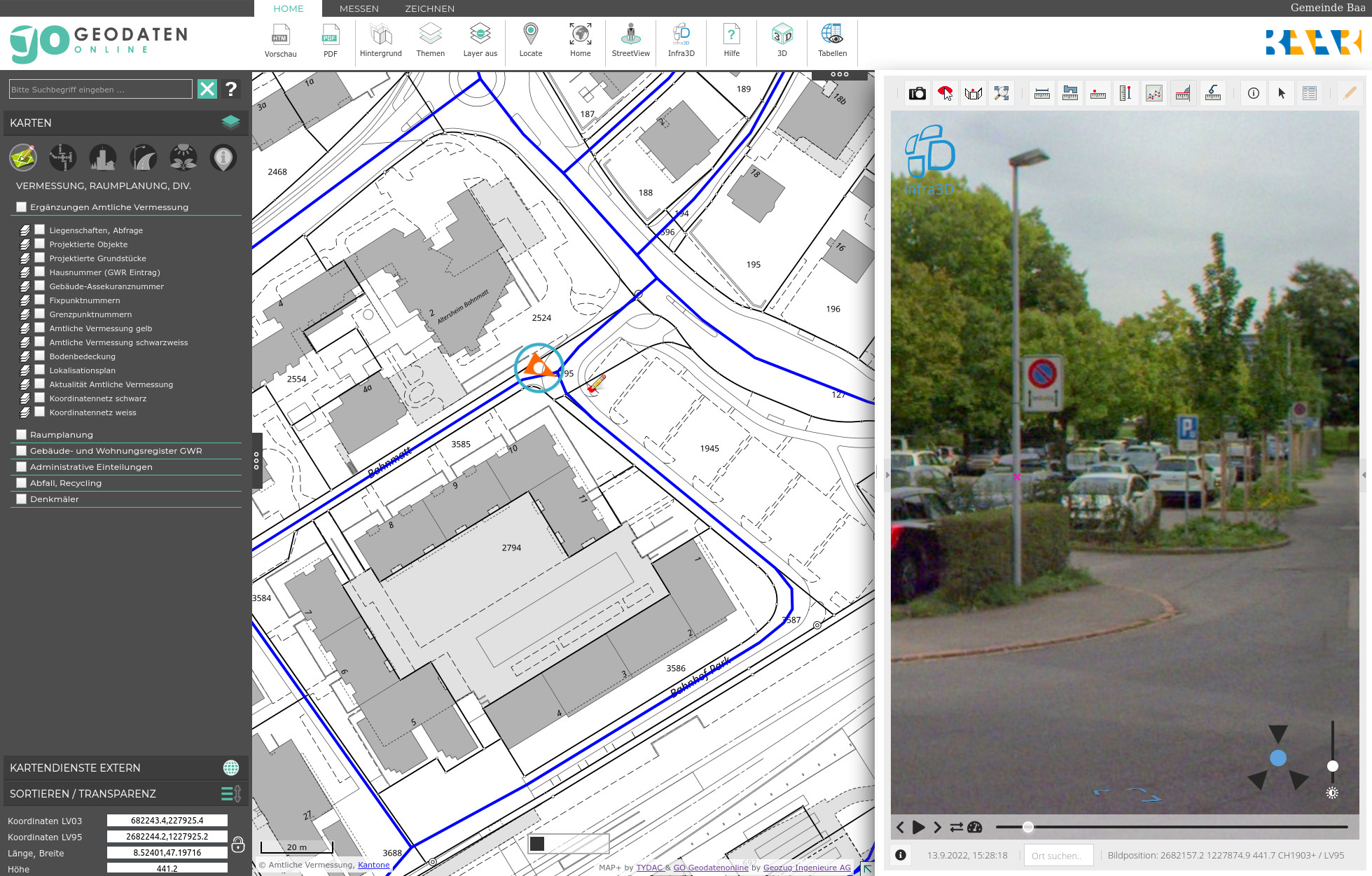
By means of the API, the Infra3D application was integrated into MAP+ (similar to Google StreetView). However, the integration goes much further here, in that it can be used for the precise collection of data. This is visualized in the figure above;
Navigation to the desired section
in the Infra3D window click on the desired object, in the figure a signalization stand
The exact location is shown in the map
with MAP+ the object can now be captured and attributed, in the example with the signalization module
With Map+ V3 modules for any applicatio area can be developed without programming knowledge:
Lists from database tables, combined with the possibility of geographical selections. Data export of tables or selections to shape, xls, csv, json etc.
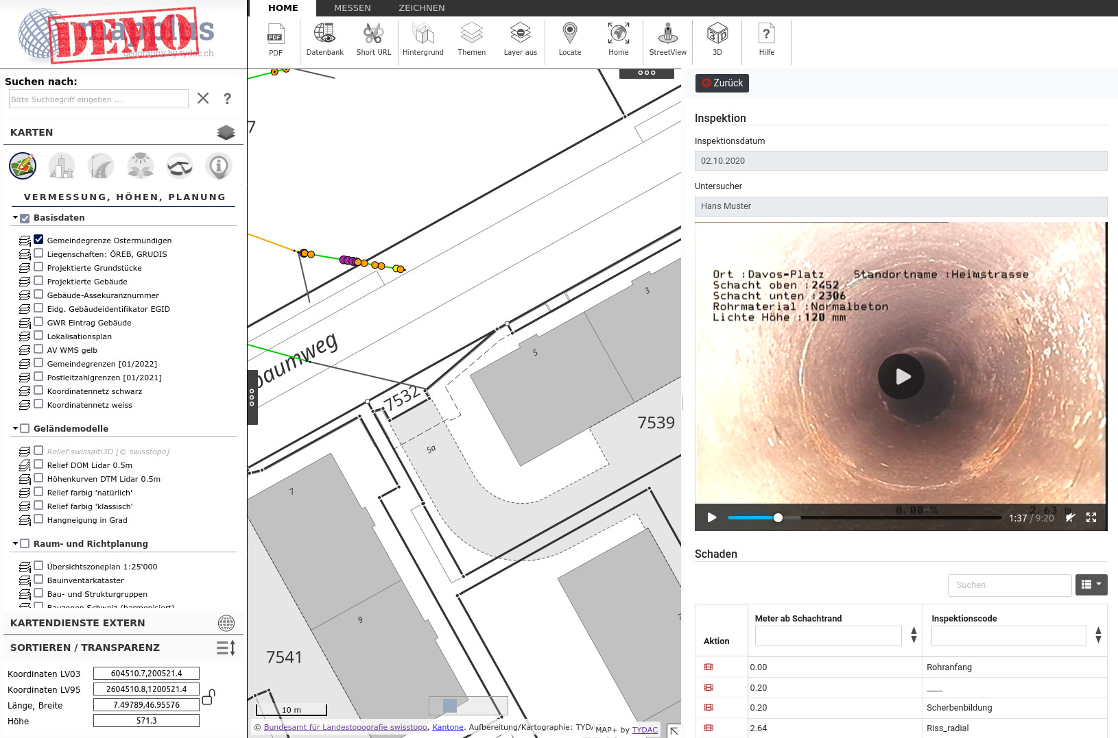
Nested forms with options for data collection via linked tables, data upload of documents, videos, etc.
PDF reports with map integration and possibility of geographic analyses such as overlays
In order to show the capabilities, we have put a demo version online. There you can see modules from TYDAC and customers, which are otherwise only visible on the intranet:
Building zones undeveloped, upload documents, TYDAC
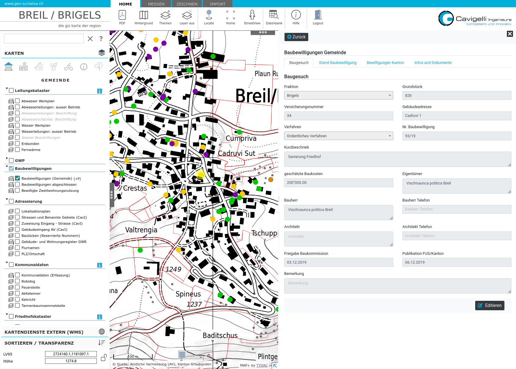
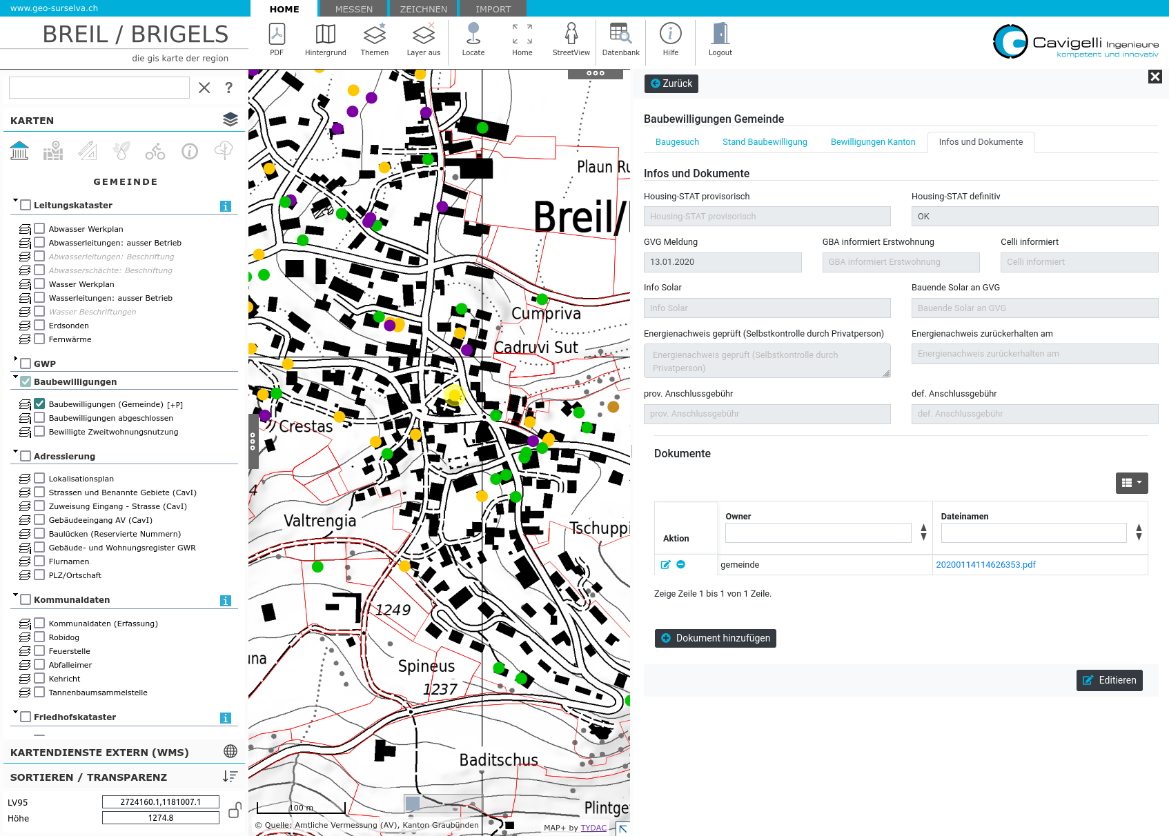
With the module building permits can be recorded, edited and archived on geo-surselva.ch ofCavigelli Ingenieure AG . Documents can also be uploaded as required for the building permits. This provides the municipality with a meaningful overview of ongoing and completed procedures. With the table and selection function, it is also possible to filter and search.
The following modules are also used by municipalities on geo-surselva:
Cemetery Administration
Roads maintenance
Projects pipeline cadastre
Hunting aids, tree protection, game fences
Kurt Vieli, Enterprise Manager:
In the area of online GIS, we have been relying on the services of TYDAC for over 20 years. Due to the very high customer satisfaction with our end users but also with our employees, as well as the short response times and high availability and flexibility of the applications, we continue to rely on the products of TYDAC. With MAP+ V3 and the possibility to develop modules ourselves, we can offer our customers even more flexible user-specific tools.
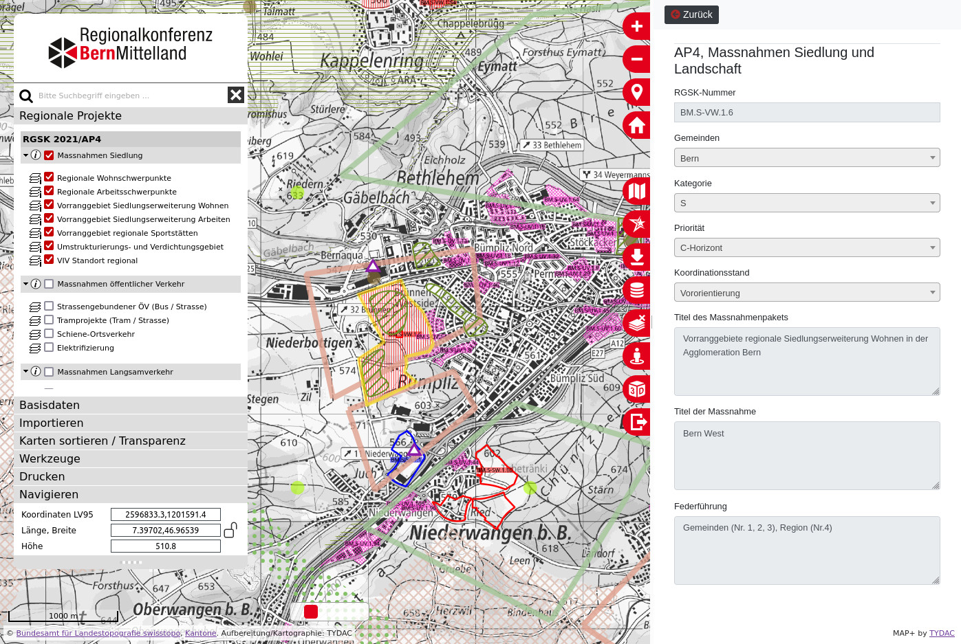
Regional Transport and Settlement Concept (RGSK) of the Bern-Mittelland Region (RKBM)
The aim and purpose of the RGSK is to coordinate overall transport and settlement development in the medium to long term and to steer them in the desired direction. The RGSK is drawn up jointly by the 75 RKBM municipalities. It is renewed every four years. The concept is an instrument with the character of a guideline plan. It creates binding and reliable guidelines for the communal local planning.
The latest version is the RGSK 2021/AP4 (agglomeration program 4th generation). The data was published at the beginning of November 2022 in the new, MAP+ based WebGIS of the Regional Conference Bern-Mittelland. Read more here.
The energy transition is a hot topic. For municipalities, it is therefore becoming increasingly important to establish and analyze the basics. Questions that arise:
What energy sources are currently available in the buildings? Natural gas, fuel oil, environmental heat, district heating, wood, etc.
What does the energy plan look like? What kind of usage is existing or planned?
What is the strategy for the future? Strategic plans, e.g. for gas.
Where does it have Minergie buildings?
Solar energy: suitability roofs and facades?
The energy city of Wädenswil, for example, has compiled all this data in its WebGIS.
Using the Federal Spatial Data Infrastructure (BGDI), federal offices have published most of their data as web services. As of August 2021, there were about 700 services available.
TYDAC has compiled through its OpenData WIKI the list of services grouped by federal office. A new MAP+ Application was set up, which shows most of the services (WMS and a selection of WMTS):
686 layers in total , including query options
virtually all with associated legend
Search function by name and keywords
in four languages: German, French, Italian, English

