hike.mapplus.ch is an extract from MAP+ Alps: Switzerland only and only what has to do with outdoor sports. Among other it includes:
Background, all in color or grayscale, brightness slider:
swisstopo national maps
swisstopo national maps "winter"
swisstopo national maps "vintage"
OSM++ Switzerland maps created by TYDAC based on OpenStraatMap data
Aerial photo swissimage from swisstopo
Maps:
Hiking trails swisstopo
Hiking hints
Hiking trails: closures and detours
Ski routes and snowshoe routes swisstopo
Webcams
SwitzerlandMobility: Hiking, biking, mountain biking, skating (winter sports to follow)
Topics gastronomy, transportation, nature and environment etc.
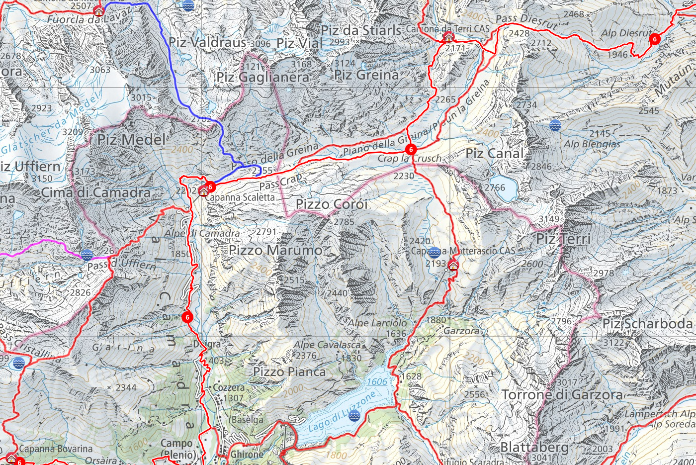
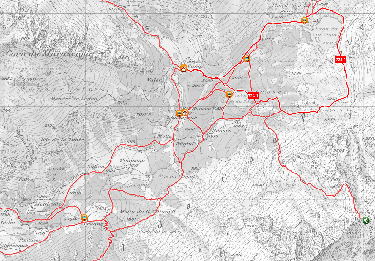
Example
National Map "Vintage", grayscale, lightened, with hiking trails swisstopo, SwitzerlandMobility hiking routes as well as huts, signposts and mountain passes:
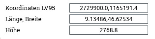
Dynamic display of location
Dynamic display of coordinates and altitude. The height of the center of the screen is also dynamically displayed on smartphones.
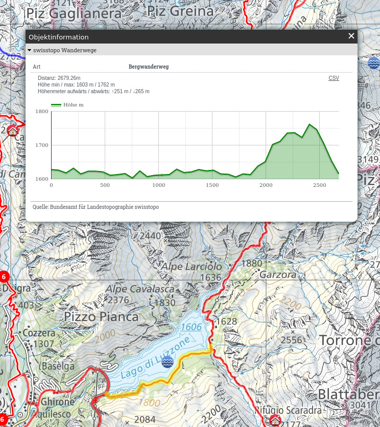
Live profile generation
When querying hiking trails, SwitzerlandMobility objects, ski routes etc., a profile is generated on-the-fly, with the following calculated data:
Distance
Minimum and maximum height
Altitude meters up and down
Moreover, with the movement of the mouse over the profile, the location is displayed in the map.
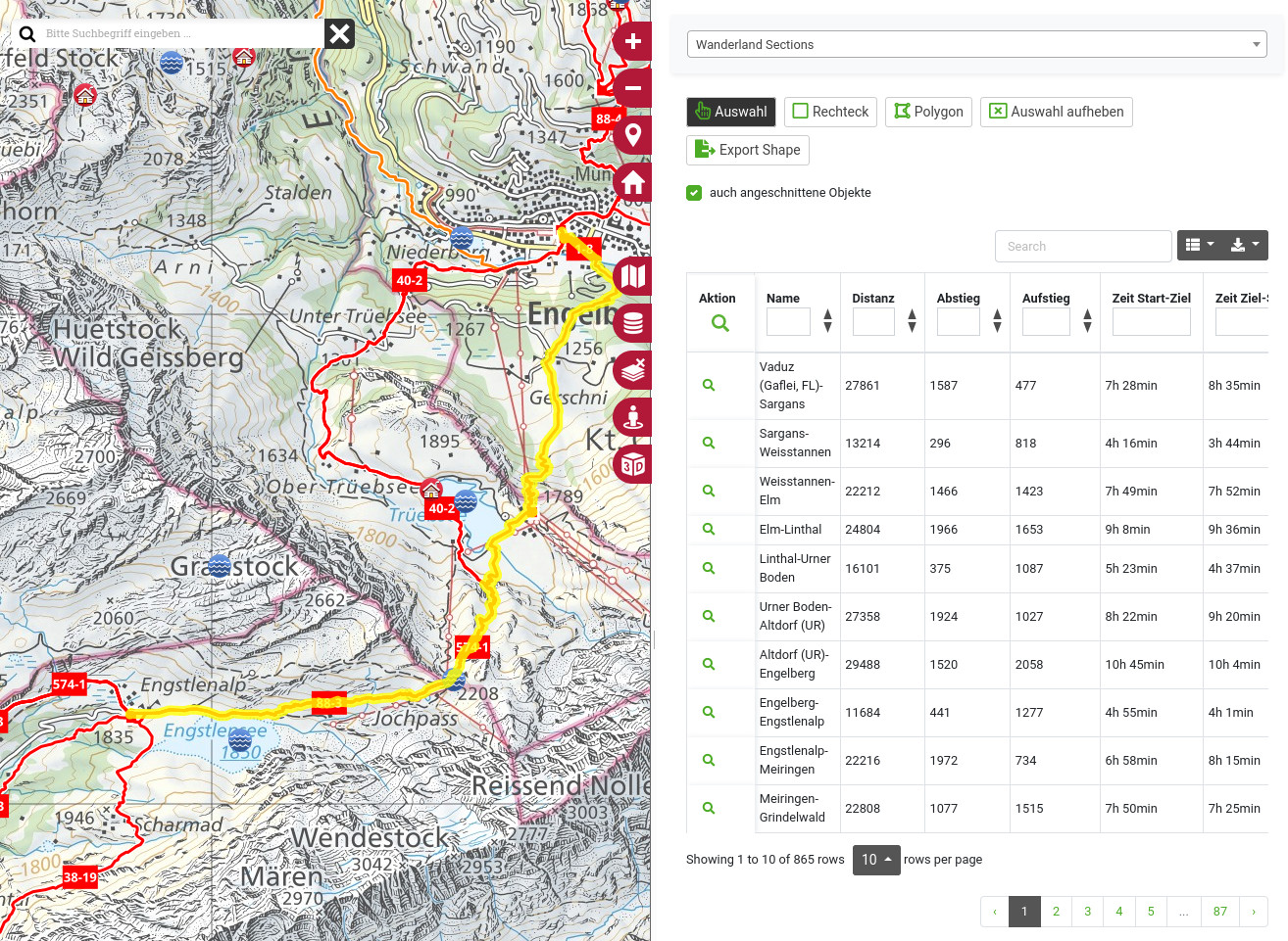
Search, selection and export
SwitzerlandMobility data can be searched via lists: