Andrea Schemmel, Project Manager Spatial Planning:
During the implementation of our WebGIS Regional Conference Bern-Mittelland solution, we experienced TYDAC as a solution-oriented, reliable, creative, cost- and time-conscious partner and would like to thank them for the very successful cooperation.
In the Bern-Mittelland Regional Conference, 75 municipalities work closely together. They coordinate cross-municipality tasks and implement joint solutions and projects. Their common goal is to further develop and shape the Bern-Mittelland region as an attractive living space for its inhabitants. Source: http://www.bernmittelland.ch
Regional Transport and Settlement Concept (RGSK)
The Regional Transport and Settlement Concept (RGSK) is the strategic spatial and transport planning instrument of the Bern-Mittelland Regional Conference RKBM. It creates the conditions for strengthening the Bern-Mittelland region as an attractive living and natural area as well as a business location. The RGSK includes measures for an efficient and safe transport network, which is of central importance for the further development of the region. The WebGIS Regional Conference Bern-Mittelland is the publication organ of the RGSK data.
June 2022: Award of contract in the tender for the new geoportal
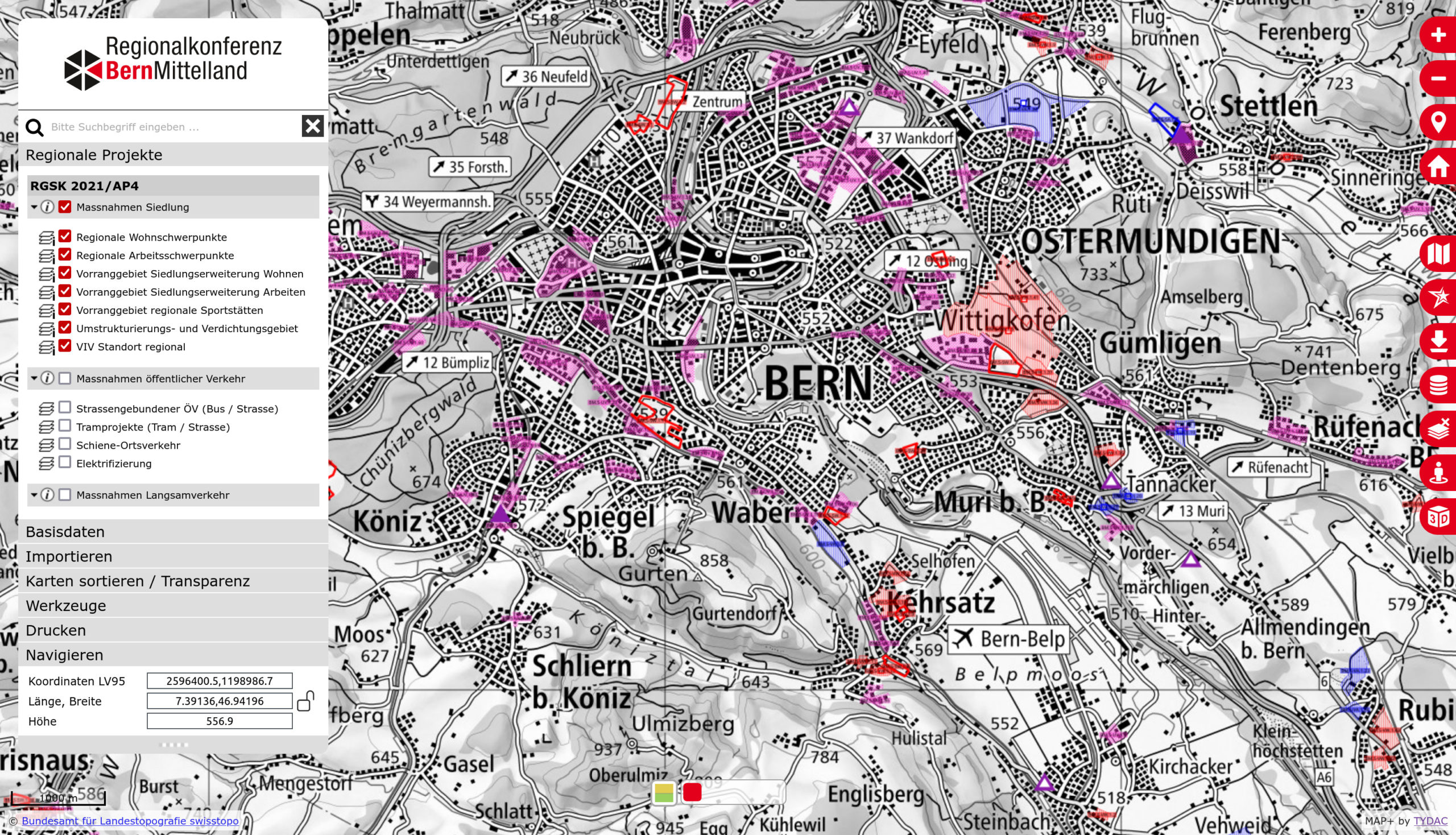
The new geoportal was developed by TYDAC during summer 2022 and and went online on November 9, 2022: https://www.webgis-rkbm.ch.
The WebGIS Regional Conference Bern-Mittelland is characterized by a new, very attractive and intuitive design of MAP+, which gives the map a lot of space. Special functions are:
Download options of the RGSK 2021/AP4 data in Shape, Excel and PDF (measure sheets)
Table view of the RGSK data with further selection and export options. Selections can be made both database-wise and geographically, as well as combinations thereof. Export to Shape, Excel, csv and others.
Form view of the RGSK data, if required these data could also be edited
In addition to the RGSK data, basic data from the areas of spatial planning and transport were also integrated, particularly worth mentioning are: