Aldo Menegon, Managing Director of Menegon Friberg Vermessungen AG:
Finally! An application that anyone can use. The user interface is self-explanatory, the operating aids simple and clear.
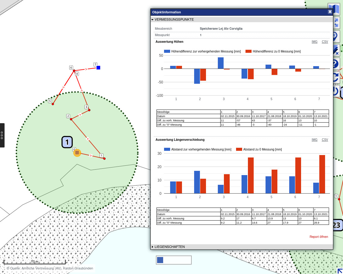
Analysis of precision measurements
Pylons and water reservoirs must be monitored by periodic precision surveys. A Summit GIS module facilitates immensely their examination and reporting (see image above):
Easy import of the measurement series
During import the data is checked for errors
Representation with scale magnification from 1 to 2'000
Export of displacements to csv
Detailed analysis as PDF report
Infrastructure Management
Nowadays, it costs around 250,000 Swiss francs to operate a larger ski resort - per day! That has a lot to do with infrastructure - and it should therefore be managed efficiently:
Transportation facilities, slopes, paths, fences, etc.
Buildings and real estate
Hydraulics and pneumatics for snowmaking
Electricity, solar panels, IT infrastructure
Avalanche protection
Anchors, slope guidance systems, etc.
Extensive functionality for data capture and editing
Summit GIS is the central application for capture and management of infrastructure:data:
Import of data collected with precision GPS devices
Possibility of importing CSV lists and DXF data as background data to support acquisition
Online editing and capturing of data based on WMS, with snap functionality
When capturing points, coordinates and height are automatically tracked as an attribute, as is the area for surface objects (e.g. slopes).
Automatically generated HTML legends directly from WMS
Selection and export of acquired data for integration into navigation systems
Summit GIS is already in use at well-known skiing resorts: Davos/Klosters, St. Moritz, Titlis, Flumserberg, Pizol.